A Lindenlea History
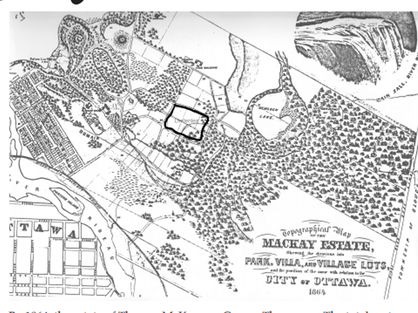
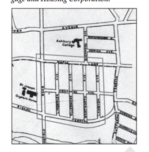
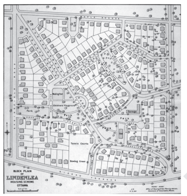
First Nations (primarily Algonquins) lived, hunted, fished, and travelled through the area where Lindenlea now sits. Their first recorded meeting with Europeans was in 1610 when Étienne Brûlé passed through on his way to the Great Lakes. The first European settlement was created by Philemon Wright in 1800. Lumber soon fuelled the economy, and by 1826, Bytown was incorporated as a town. In 1855, the City of Ottawa was incorporated, absorbing Bytown. The position of the city was solidified in 1857 when Queen Victoria chose Ottawa as the site of the capital city for the new Dominion of Canada. Thomas McKay (1792–1855) emigrated to Canada in 1827. In 1837, after finishing the canal locks, he built a limestone mansion on 1,100 acres of land just east of Bytown. Today, Rideau Hall is the official residence of the Governor General. Much of the land that Mackay purchased became the Village of Rockcliffe Park (now part of the City of Ottawa) and the neighbourhoods of Lindenlea and New Edinburgh. By 1864, the estate of Thomas McKay was selling park, villa, and village lots from the western part of the property. The estate lots changed hands a number of times between 1864 and 1919 when the City of Ottawa purchased what is now Lindenlea (22.2 acres at $3,000 per acre) from the estate of Mr. George Thompson. The total cost was $67,581.28. The Sisters of Charity also acquired some of the McKay property; in 1895, they built an orphanage and school located where the convent and St. Brigid’s School now reside. The accompanying plan of the Lindenlea property in Ottawa was prepared in July 1919, on the instructions of the Housing Commission of the City of Ottawa. The 22 acres was purchased at $3,000 per acre. Originally, it was laid out with rectangular streets which had been planned without regard to the topographical conditions of the site. In acquiring this estate, the Ottawa Housing Commission had an exceptional opportunity to create an ideal garden suburb. The land, at a high elevation and surrounded by open country, was sufficiently undulating to give it character and interest without making it costly to develop, if carefully planned. A large part of it was covered by beautiful trees, most of which could be preserved without detriment to the building lots. The cost of the property was somewhat high, considering the object of the Commission was to erect small houses which could not bear to be saddled with a high cost for land. Provision would have to be made for through traffic across the property in laying out the plan of streets. The only through traffic route necessary was from the southeast to the northwest corner of the property. This gave rise to the planning of Rockcliffe Way for the purposes of through traffic and also as the backbone of the remainder of the plan of streets. Rock Avenue is a fork road with two arms 20 feet wide, each running on both sides of a rock outcrop. The cost of removing this rock would have been greater than the value of the land for building on and instead of being allowed to be an encumbrance, it was converted into as asset by the treatment shown in the plan. The open spaces comprise tennis courts and a bowling green, park with Proud part of the Lindenlea community. children’s playground, and parkway and other small areas making a total of 118,734 sq. ft. The subdivisions were made with a view to ensuring wide frontage and some back garden, without extensive depth. The number of lots is 168 and the average price recommended to be asked for each lot was 12.5 cents per square foot or $457 per lot.
Excerpted from the Journal of the Town Planning Institute of Canada, Volume 1 (3), April 1921, pp.4–5. Reprinted with kind permission of the Canada Mortgage and Housing Corporation.
Excerpted from the Journal of the Town Planning Institute of Canada, Volume 1 (3), April 1921, pp.4–5. Reprinted with kind permission of the Canada Mortgage and Housing Corporation.


